UN
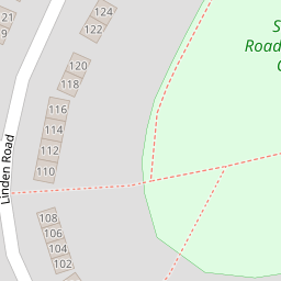
63 Linden Road
£ 174,000
Description
We don't have a Description for this property.
- Bedrooms
- 3
- Bathrooms
- 0


Leaflet © OpenStreetMap contributors
The heatmap indicates the level of crime in the area. The color of the heatmap indicates the crime severity and recency.
Metrics Year-on-Year
- Average area value
- 261,822.00 £Decreased by 14.93 %
- Average area rental value
- 1,072.00 £/moIncreased by 3.57 %
- Est rental Yield
- 4.91 %Increased by 21.53 %
- Crime Rate
- 7.00 %Unchanged by 0.00 %
from 307,765.00 £
from 1,035.00 £/mo
from 4.04 %
from 7.00 %
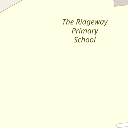
Nearby Schools
| Name | Type | Ofsted | Distance |
|---|---|---|---|
| The Ridgeway Primary School | Community School | Good | 0.09 KM |
| Leighton Park School | Other Independent School | 0.46 KM | |
| Crosfields School | Other Independent School | 0.68 KM | |
| Whiteknights Primary School | Academy Converter | 0.91 KM | |
| Blagdon Nursery School | Local Authority Nursery School | Outstanding | 0.92 KM |
Images
Nearby Streets
| Name | Average Price | Average Sqft | Distance |
|---|---|---|---|
| Fair Lawn Green | £ 0 | 0 | 0.00 KM |
| Ryhill Way | £ 625,000 | 0 | 0.00 KM |
| Whitley Wood Road | £ 450,000 | 0 | 0.00 KM |
| Hilary Close | £ 0 | 0 | 0.00 KM |
| Tiptree Close | £ 0 | 0 | 0.00 KM |
Nearby Transport
| Name | NLC | TLC | Distance |
|---|---|---|---|
| Earley | 5694 | EAR | 3.87 KM |
| Reading | 3149 | RDG | 4.10 KM |
| Reading West | 3160 | RDW | 5.30 KM |
| Winnersh Triangle | 5698 | WTI | 6.62 KM |
| Winnersh | 5697 | WNS | 8.16 KM |
Nearby Listings
| Address | Price | Type | Score | Distance |
|---|---|---|---|---|
| Hillbrow, Reading, Berkshire, RG2 | £ 325,000 | BUY | 6 / 10 | 0.21 KM |
| Hillbrow, Reading, RG2 | £ 325,000 | BUY | 7 / 10 | 0.24 KM |
| Tamarisk Avenue, Reading, Berkshire, RG2 | £ 500,000 | BUY | 7 / 10 | 0.26 KM |
| Newstead Rise, Reading, Berkshire, RG2 | £ 225,000 | BUY | 5 / 10 | 0.26 KM |
| South Reading / Shinfield borders, Berkshire, RG2 | £ 250,000 | BUY | 6 / 10 | 0.26 KM |
Nearby Properties
| Address | Price | Distance |
|---|---|---|
| 53 Linden Road | £ 407,000 | 0.00 KM |
| 55 Linden Road | £ 299,995 | 0.00 KM |
| 149 Linden Road | £ 187,000 | 0.00 KM |
| 77 Linden Road | £ 141,950 | 0.00 KM |
| 63 Linden Road | £ 174,000 | 0.00 KM |